
Here are some great -with details- hiking paths of Amorgos, sent to us by Irene Giannakopoulos.
From Chora to Katapola
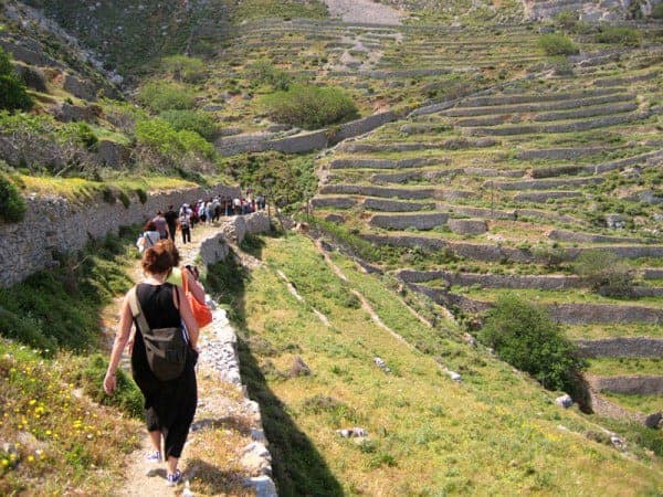
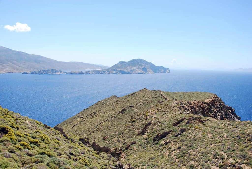
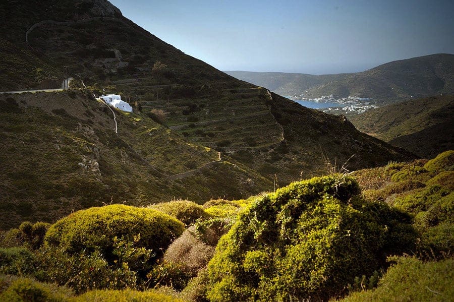
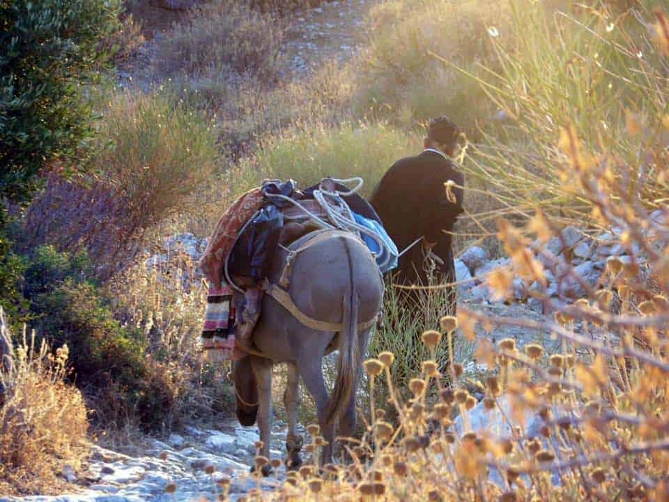
The route begins at Chora, about 50 meters north of the parking area, next to the sign that points to Katapola, Arkesini, and the helicopter runway. The route with the red and white mark “2” connects Chora with Katapola in about half an hour. The path is old, and actually, it looks like a traditional path for donkeys. Between dry stonewalls and rocks, the trail leads us downwards, going past the northern precipice of the hill in front of us. On the right, a valley is situated. At this specific point, if you turn around and look at Chora, you realize that Chora looks like a swallows-nest on the mountain.
In about 15 minutes from the start of the route, four-pointed turnings led us much lower. At the end of these turnings, on the left, ends a path coming from above. We remain in our path, and – in a while – we arrive at two narrow turnings. We see an old tree leaning towards the path (because of the wind) and giving its shade away in a few minutes. After nearly 7 minutes, we arrive at a dry spring, and then we can find drinkable water on the right side of the path.
Frogs can be heard croaking, and a sage smell fills the air; the place invites us for a short break! After that, the path becomes narrower and narrower because of the existence of bushes. However, this is not a severe difficulty at all. After 10 minutes of walking down the path, the magnificent view to the bay of Katapola lies there – in front of us! Ten minutes more, and we are in a small crossroad; we follow the road leading straight into the destination of Katapola, and – here we are – in the port of Katapola, after going past the chapel of St. Irene.
Walking time: About 1 hour
From Arkesini to Vroutsi (route number 3) and then to Katapola
Route number leads us to the southern part of Amorgos, which is rarely visited by tourists and is called “Kato Meria by the locals.
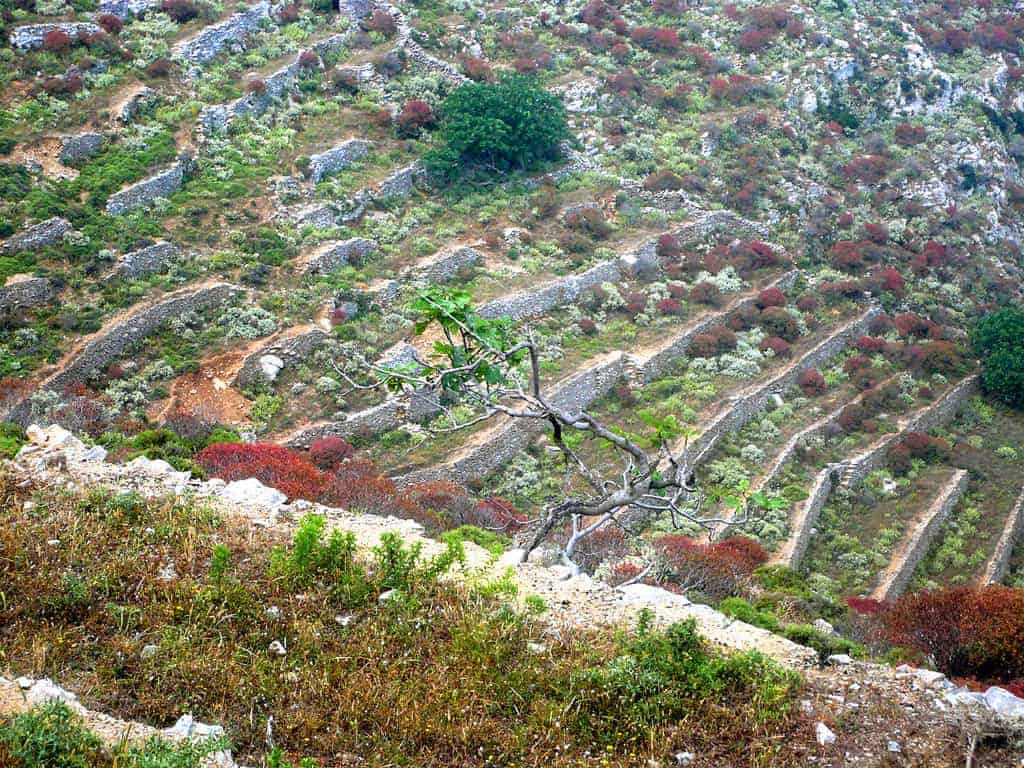
Setting off from the little village Arkesini, we go along the long path that is mostly well preserved but has been replaced by road for cars in the end. It is a trip with small heights and a great view to the small eastern Cyclades and to Naxos, as well as with little valleys above the villages Rachoula, Vroutsi and Lefkes. Walking along this road is relatively easy without significant hypsometrical differences. It is a distance of 13 km with a duration of about three and half hours of walking. However, the route has been marked only from Arkesini to Vroutsi with red and white signs and with number 3.
From Vroutsi to Katapola, we see very few blue or red marks and some wooden signs showing the way to one of the small villages or the little churches of the area. Despite this fact, the route is generally straightforward. The start of route number 3 is found in the northern part of Arkesini. A little path branches off the main road (on the right) towards the archaeological side of the Holy Trinity. Just before the remnants of an impressive Hellenistic outpost, we see the first sign with the number 3. Following the road along the stone walls, we get a cistern after a while. From there, we go on a little downward.
In a while, we see the village of Rachoula. In about 20 minutes, we get to the first houses of the small town after walking on a steep upwards road. We go across the village through an asphalted road, and we get to a parking space near a bit of church. We take the road leading to the left, along high stonewalls around a precipice from the end of the square- which is diagonally opposite. Then, the road branches off to the right going up from a ridge. Five minutes after getting out of the village, we see the end of a road coming from below.
In Vroutsi, we have the opportunity to take a break in the cafe for some food and rest. We walk through the village, going past the baker and the post office to the church St. Spiridon with the blue dome (in the southeast exit of the town). Then, we follow a concrete road towards the asphalted road that we reach in 10 minutes. Following the road to Chora, we get to the church of St. Stavros with the three narthexes. Right opposite is an inconspicuous tavern. The road turns left behind the church towards a country road. At a stable, it turns right, and it is cobbled up to a certain point. In 5 minutes, we see another road on our left hand leading to the hill “Vigla” with the homonymous little village. We remain in our path that – so far – has signs to “Agia Thekla” and “Kastri.” The trail leads us to a valley.
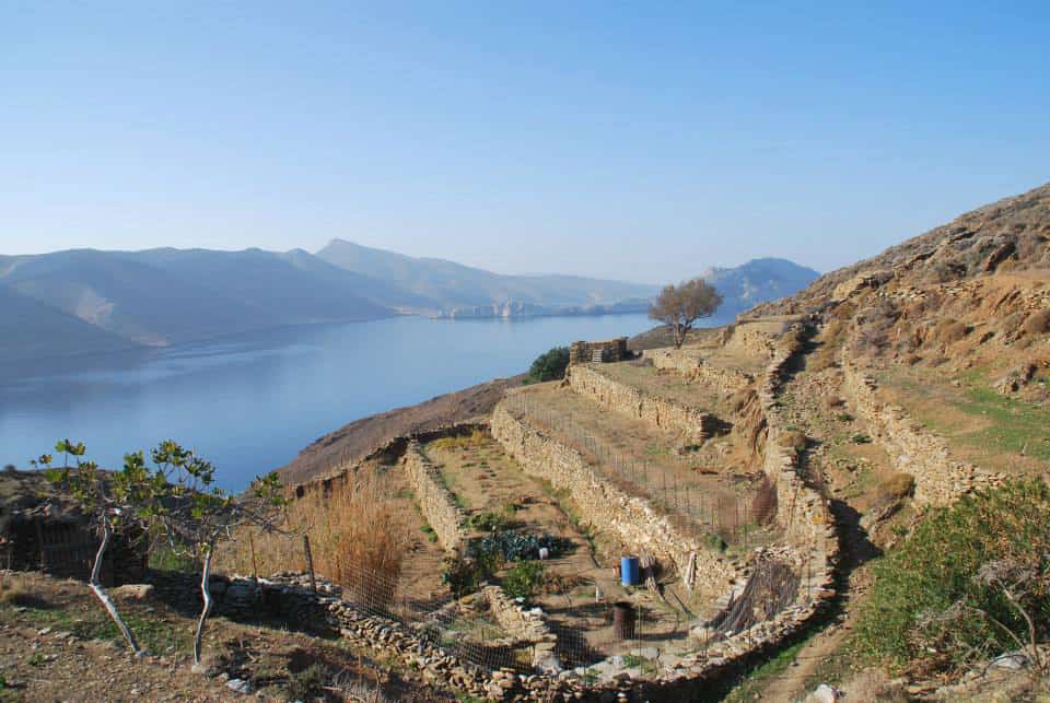
Next to the path, we see a gully with vegetation. In the deepest part of the valley, we cross a small bridge and a dry brook. On the other side, we go on upwards. We get to a col in half an hour where enough stock-farms from natural stone have been constructed. From this point, we have a nice view of the monuments from Ancient Arkesini (Kastri), which lies a considerable distance southwest. Down in the center of the valley, we discover the church of St. Saranta with two narthexes. We return to the valley again. On our right side starts a small gully that gets wider and deeper and leads down the valley. Having almost arrived at the deepest part of the valley, on a left turn, the view to the bay of St. Saranta is presented.
In the gully, the oleander plant is in bloom, which is an indication of plenty of underground water. On our left, next to the dry brook, there is a palm tree. In about 25 minutes from the cols behind us, we get to the widest point of the valley. We go on the road opposite, passing by another small church. After 15 minutes of climbing, we get to a crossroad; on the left lies the village and the country church of Agia Thekla. The small settlement lies high, above two blue bays. However, we follow the road on the right (road for cars), and we will go up the mountain to view the village Lefkes and the hill Minoa. 10 minutes after Agia Thekla we get to Lefkes.
Below us on the left we can see a bay suitable for swimming; it is the “Finikes” bay where a road for cars leads. About 20 minutes after Lefkes, we arrive at the church of Stavros, which is famous for its marble. From here, we see for the first time the bay and the valley of Katapola. A little behind the church turns the road to the fascinating archaeological site of Minoa. We follow the road going down the valley. Behind a vast beetling cliff, we can see a path going to the center of Katapola.
Walking time: about three and a half hours
A “promenade” round the bay of Egiali
The circular road with number 4 leads us from the port of Egiali through the two mountainous villages Tholaria and Lagada, and ends at the port area again. The whole walk takes nearly 2 hours. In this walk, we encircle the amphitheatrical valley behind the bay of Egiali through paths for donkeys. Traditional stone walls smell from herbs, and beautiful views of the “stepped” fields and the bay of Egiali are the essential features of this walk.
The trip starts from the path which connects Egiali with Tholaria. After you have passed by the sign indicating the end of the Egiali area, there is a small country church (St. Theodori). On the right side of the church, an asphalted road branches off towards some houses above. In a distance of about 10 meters along this road starts a narrow path. After following the trail, we soon discover a small red and white sign with the number 4. This is the mark to be observed from now on. We walk along the propping and arrive at an old stepped path leading to another small church after 10 minutes. The trail goes on upwards, and – in 10 more minutes – a spring built within the rocks invites us for a short break. A bucket is always there in case someone wants to give water to the animals. In a short distance after the spring, a road branches off abruptly towards the valley. We go on towards the left direction and walk along the precipice to Tholaria. Ten minutes after passing by the spring, we arrive at the large parking area of the village. We go towards the big church of St. Anargiri and then take the stepped path on the right below the church. At the first turning of the road, we go left up the stairs. Our route has now become apparent through the precipice behind the village. After having walked for about half an hour from the exit of Tholaria, on a cobbled path with a great view to the bay of Egiali, the route makes a big turn to the right.
On our left hand, we can have a view of the small church St. Taxiarchis below. A little after that, there is a wooden sign indicating “Astratios” on the left side of the path. However, we go on straight forward to the direction of the hill “Pagos.” In a few minutes, we arrive at a crotch with a sign. At this specific point, the path leads to a road that encircles half of the hill. About 10 minutes later, we can see a brilliant white church; it is the church of “Panagia Epanochoriani.”
The sign for route number 4 leads towards the hill. Following the route, we would arrive above the small village “Stroumbos.” But our destination is the church of “Panagia Epanochoriani” with a great view and a peaceful yard with the shade of cypress trees. Therefore, we go down to some stairs on the left towards a small gorge, and we go past a cistern made of corrugated sheeting. In 5 minutes, we stand in front of the magnificent white church. The place is ideal for a more extended break to enjoy the view and the quietness. There will be no doubt that the “deviation” from the usual route was worthwhile. Leaving the church area, we follow the white path downwards and cross a small gorge.
In 5 minutes, we arrive at the crossroad, which leads – on the right – to the monastery of St. Theologos (4 Klms) and the church of Stavros. However, we follow the stepped path with the direction to Lagada. It is a path strewn with sage, oregano, and many other sweet-smelling herbs. On the right, we can see another small white church and the small village, “Stroumbos.” Going straight on, we arrive at the mountainous town Lagada. We cross the village through the central stepped road, and we go past the fascinating square in the city named “Loza.” It takes about 5 minutes from the entrance of the town to get to the exit. We follow the cobbled path, which passes on the left of a cistern and leads downwards to the port of Egiali. The trail is built between small stone walls. Oak trees accompany us on our trip. Nearly halfway to Ormos, we cross the asphalted road. It takes about half an hour in total to get to Ormos.
Walking time: About two and a half hours
The lonely rocky rampart – tracing the miners above the picturesque monastery of St. Theologos towards the church of Stavros
To walk towards the small church of Stavros on the highest mountain of Amorgos (Krikelos) is an extraordinary suggestion. The route leads us from the mountainous village Lagada, above the deserted monastery of St. Theologos, to a valley northeast over the island, which is one of the loneliest places of Amorgos. We seem to be tracing the miners – the local people who used to work very hard in the bauxite mine 700 meters below the church of Stavros. Even though there used to be placed for the miners to reside in the mine, local men from Tholaria and Lagada used to go there daily and come back after finishing their shift. This is something unbelievable for us, especially after having walked all this distance! The mine closed down in 1943; up to 150 people had worked there. From 1976 to 1981, some new experimental drillings took place, and the mine was full of life again. Today, it is deserted. Going down to the mine from the church of Stavros must be very strenuous, while getting into the plant of the mine is very dangerous.
Our trip starts from the square of Lagada “loza” and then, you turn right and cross the village until you reach its eastern exit. We follow the asphalted stepped road. About 5 minutes after the village square, you will see some steps coming up from a small gorge; on the other side of the canyon, the small “stroumbos” is located with some renovated houses right on the top of the rock.
We keep walking along the main road. In 5 minutes, we arrive at a crotch, which leads us – on the asphalted road – to the beautiful church of Panagia Epanachoriani.
We take the path upwards on the right, which is indicated by a small blue sign with some general distance directions; “to the monastery of St. Theologos (4 Klms)” and “to the church of Stavros (7 Klms)”.
The path is quite steep upwards; it consists of cobbled steps in some parts but irregular stones in other parts and jagged rocks in some other parts. The track is located between small walls. Behind the walls, there are fields with goats, which explain the sound of hundreds of bells jingling in the fields. In about 20 minutes after the crotch of the road, a path leads to a minor way downwards. We keep following the stepped path upwards. In about 35 minutes after the crossroad, we go across a dry brook directed from the left upwards to the right downwards. However, we keep heading to the deepest part of the valley, which is before us. The path now has become very rocky. A red arrow on the drywall indicates the right direction.
After a rather steep road, we will have almost finished with the most challenging part of it. Our rambling continues on a shady path between high stonewalls. A lot of oak trees create surprisingly green scenery. In about 50 minutes after the crossroad, we arrive at the church of St. Barbara on the right side of the road. The best honey on the island comes from this specific place. The yard of the small church is suitable for a short break and offers a first view of the great monastery of St. Theologos, which has been repaired in recent years. After the church of St. Barbara, the straight path goes on for about 5 minutes. Then, we meet a crotch next to a small white shepherd house. The road leads to the monastery; it is a beautiful place worth visiting. In front of us – in the east and the north – we view the Aegean Sea.
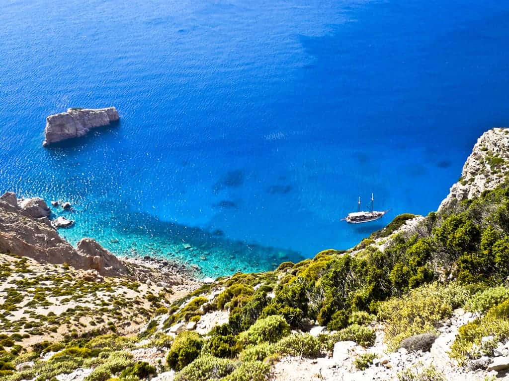
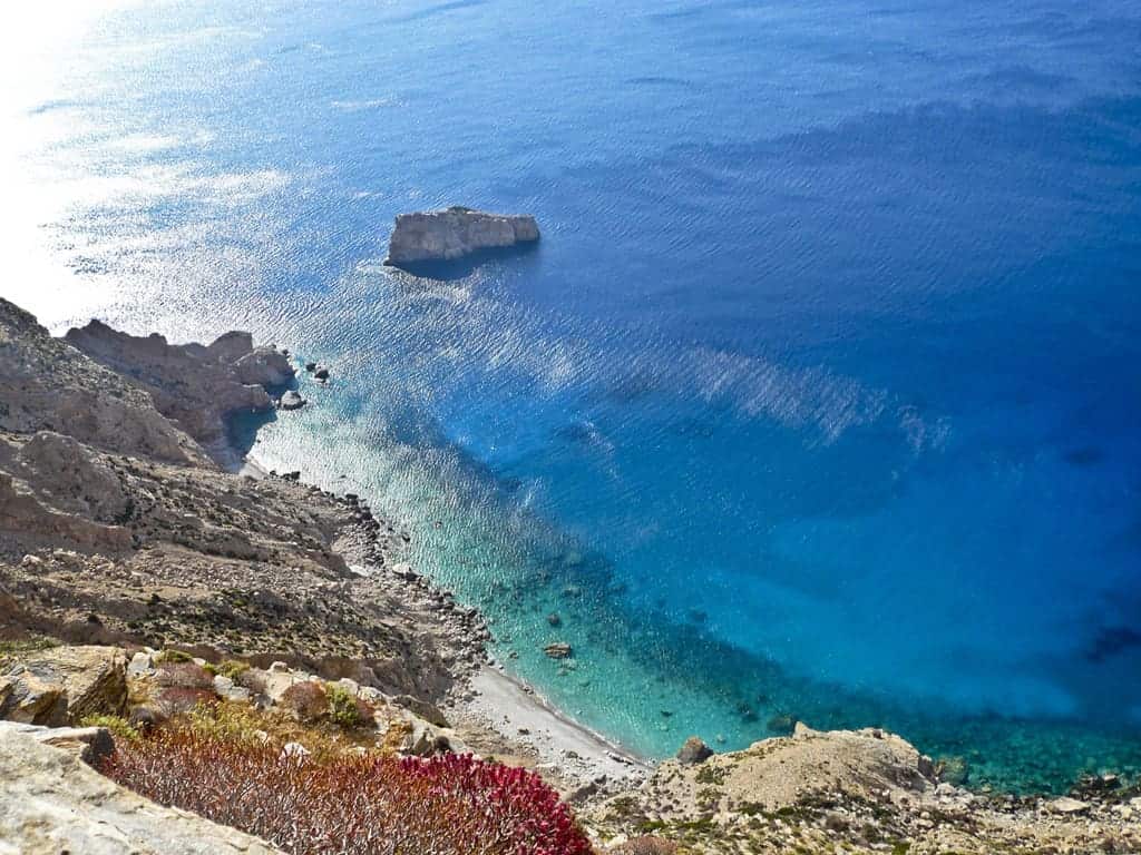
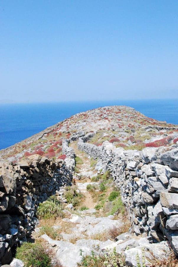
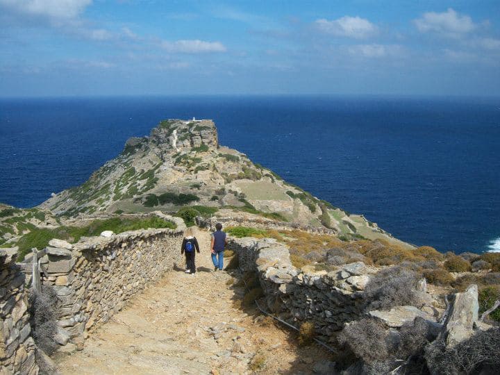
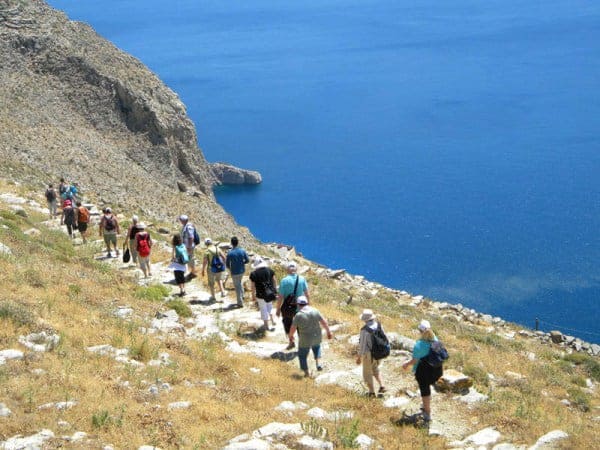
We walk along a high wall, which – in some parts – is higher than 2 meters. At a certain point, the path turns left; right here, we can see blue and red signs. Half an hour after going past the crossroad (to St. Theologos and Stavros), we are at the top of a cliff on the northeast shore. We can see high gray cliffs ending abruptly in the sea. On our right hand, we can see high on the precipice the line of the path we will follow. From such a distant point of view, the way looks more dangerous and narrower than in reality. However, if someone has a phobia of high altitudes should stop at this specific point. When the visibility helps, the view from here is magical.
Northwards we can see the island of Ikaria, while at the northeast, we can see Patmos. A lot of small islands can be seen around. Having enjoyed the view, we follow the narrow but well-defined path, which with an average inclination, leads in about half an hour to the church of Stavros. There are share cliffs above us, while right below the cliffs – 700 meters in height – fall deep into the sea. After some more rocky space, we have finally arrived at our destination.
The small church of Stavros lies on the rock, right between the mountain of Krikelos (on the right) and the hill of Papas (on the left).
Apart from the church, we can see two buildings where all the equipment necessary for the annual festival (14th of September) is kept. On that day, people from all over the island gather to attempt the Holy Service, to eat and drink. Should someone like to walk along the valley towards the mountain “Papas,” he\she will discover a path with a fantastic view to the southeast coast of Amorgos, that is, the peak of “Profitis Elias,” the banding road to the beach of St. Anna and the monastery of Hozoviotissa that looks like a tiny white mark on the mountain? This path also leads to the deserted bauxite mine called “metallio.”
If someone has enough energy – despite the impending return to Lagada through the same route – he\she could climb to the peak of Krikelos. The climbing is about two and a half km and mainly without any paths. The hypsometrical distance is about 100 meters. Even climbing to the peak of Papas (800 meters) can be possible, but local people do not recommend it since the conditions of climbing can be extremely difficult.
We return to Lagada on the same path. After the church of St. Barbara, we almost run with the terrific view to the bay of Egiali in front of us.
Walking time: 4 hours of walking to Stavros and back again.
Chora & Chozoviotissa Monastery (to Aegiali)
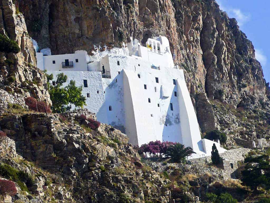
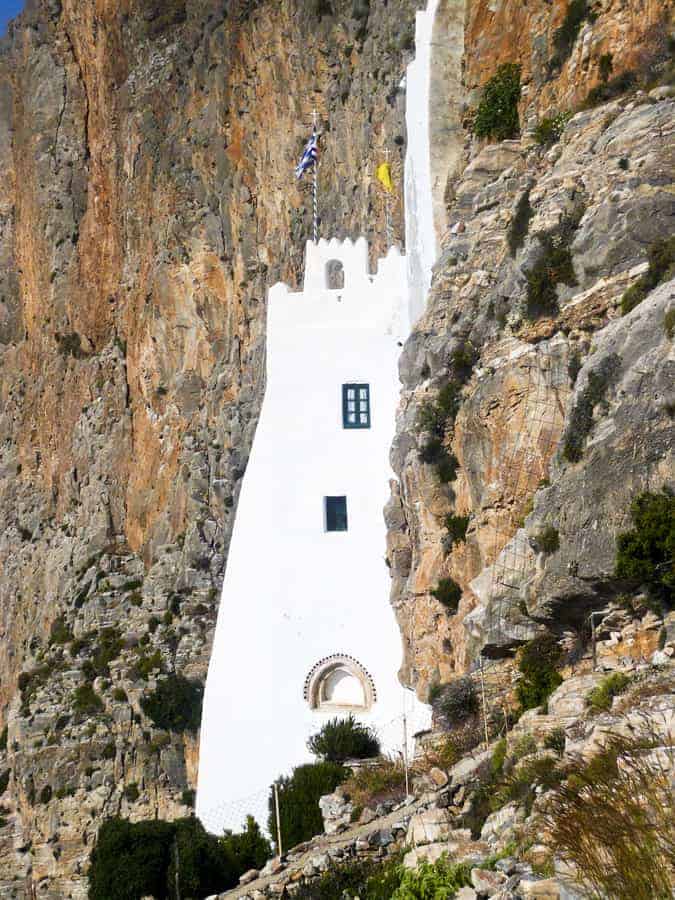
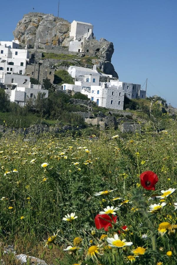
Early this morning, we traveled by road to Chora, the capital of the island. We will pause here to stroll about the village, set high above the sea protected from pirates of bygone days. We leave the village and follow a magnificent staircase going down to the Monastery of Chozoviotissa. The monastery is home to the revered icon of the Virgin from the Holy Land. The dazzling white building, founded in the year AD 1099, clings precariously to a cliff face. The icon was found in the sea below the monastery, having arrived here unaided from Asia Minor, Cyprus, or Jerusalem. We will enter the monastery and climb into its snug interior. Hopefully, the docent will show us around and provide access to the tiny but fascinating museum.
After we visit the monastery, we commence our hike.* This is one of the most fabulous hikes in the Cyclades. We follow the island’s spine and discover some unique landscapes and flora and, of course, some spectacular views. Leaving the monastery, we climb a staircase into an impressive landscape; the silence is overwhelming. High above us towers a vast cliff, and on the right, you see the deep blue sea below. Twenty minutes after the monastery, we get to a platform with remnants of stable walls–“Asfodilitis” with well complex and famous rock carvings. Behind us, the highest top of the monastery is just disappearing. We continue through the impressive and rocky wilderness; soon, we reach a kind of saddle with the two coasts of Amorgos both before and behind us. Soon we come to the Xenodochio, the remnants of a type of medieval hotel on the road from Chora to Aegiali. Gradually we get a great view of the elongated offshore islet of Nikouria.
At Exo Meria, situated on a rocky plateau, we find some deserted houses and the ruins of two windmills. It is hard to imagine how difficult and lonely life must have been on this desolate spot. The trail now continues like a magnificent balcony: far away, you can already distinguish the village of Tholaria, and all of a sudden, you get a great view on the bay of Aegiali, where our hike ends at a lovely beach where you can cool off and relax until dinner.
Walking time: Approx 4-5 hours (actual walking, more prolonged with stops) on uneven, undulating terrain. The path is quite well worn at first, though in places, the route becomes quite vague. Expect loose stones and gravel. There is no shade along the trail, and one can expect a chill wind, especially in the spring (though the spectacular wildflowers make up for this!).